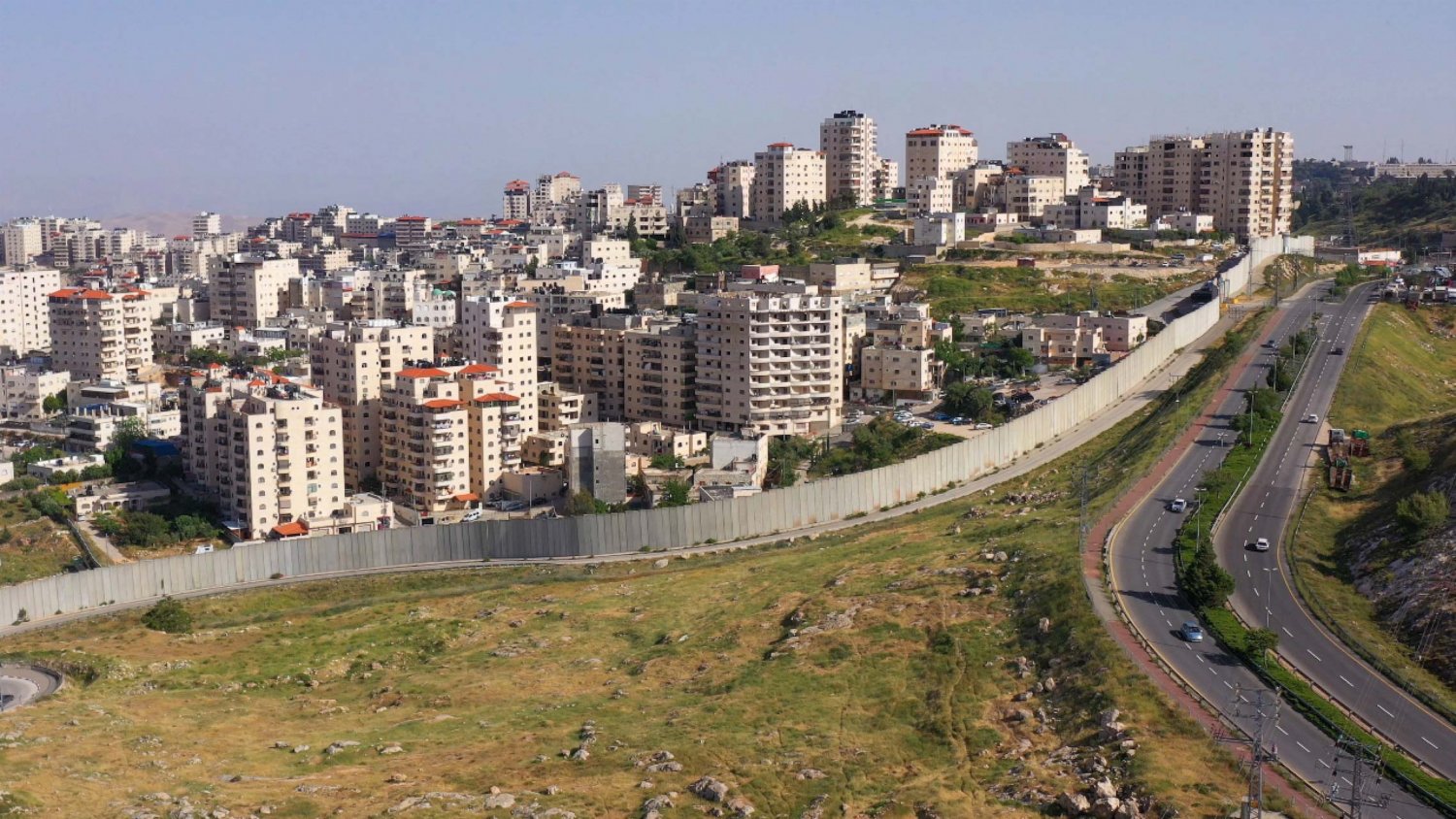
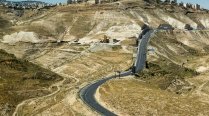
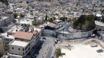
The Separation Wall: Shu‘fat refugee camp is on the outside, “exclaved”; the Israeli settlement of Pisgat Ze’ev is on the inside, “enveloped” into Jerusalem. (Undated)
Credit:
Shutterstock
Source:
Shutterstock
Israel’s concrete Separation Wall, begun in 2002 and now about 800 km long, poses a direct threat to Palestinians’ daily lives and collective existence. The wall trespasses on occupied Palestinian lands throughout the West Bank, cutting off historically interdependent communities from one another and turning many of them into isolated ghettoes.
The wall is one part of a complex urban engineering system that, together with settlements, roads, and a permit regime, births a Jewish “Greater Jerusalem” while simultaneously amputating Arab East Jerusalem from its regional context, atrophying it, and fragmenting Palestinian collectivities all around it, blocking any future possibility for a Palestinian entity to ever lay claim to Jerusalem in the future.
The Separation Wall: Shu‘fat refugee camp is on the outside, “exclaved”; the Israeli settlement of Pisgat Ze’ev is on the inside, “enveloped” into Jerusalem. (Undated)
Credit:
Shutterstock
Overview of Israel’s Separation Wall
Up to 9 meters high, Israel’s concrete Separation Wall is arguably the most visible sign of the government’s efforts to separate Palestinians in the occupied West Bank, including East Jerusalem, from Israeli Jews and from one another.
The wall is part and parcel of Israel’s settlement enterprise, a huge network of Israeli-only bypass roads, as well as a complex system of permits controlling Palestinians’ mobility across the West Bank (see Jerusalem: A Closed City). This massive “regime of separation” fragments and isolates Palestinian communities in the West Bank, including Jerusalem, where ethnic segregation contributes to further Judaizing of Palestinian land.1
While Israel consistently claims that the wall is justified by its “security” needs,2 Palestinians insist otherwise. For Palestinians, al-Jidar, as the wall is called in Arabic, facilitates the political goal of controlling and annexing as much land to Israel as possible with as few Palestinians as possible.3
As a contentious massive structure built largely on occupied Palestinian land, al-Jidar mutilated and fragmented Palestinian lands, segregating communities from each other, isolating villages and neighborhoods from their surroundings, and alienating residents from their lands and broader social and welfare infrastructure. After two decades of expanding walls, fences, barriers, checkpoints, and gates, the wall has had inestimably catastrophic outcomes on the geographic, social, economic, and daily lives of Palestinians, changing the entire socioeconomic and communal fabric of the place and causing fragmentation, isolation, impoverishment, alienation, and desperation.
Indeed, the Separation Wall violates the rights of Palestinians to mobility and access to their own lands. It was the object of major legal appeals that found it to violate international and humanitarian law. On December 8, 2003, the International Court of Justice (ICJ) considered the consequences of these violations, “recalling Israel’s obligation to respect the right of the Palestinian people to self-determination and its obligations under humanitarian and human rights law.” In conclusion:
The Court stated that Israel must put an immediate end to the violation of its international obligations by ceasing the works of construction of the wall and dismantling those parts of that structure situated within Occupied Palestinian Territory and repealing or rendering ineffective all legislative and regulatory acts adopted with a view to construction of the wall and establishment of its associated régime. The Court further made it clear that Israel must make reparation for all damage suffered by all natural or legal persons affected by the wall’s construction. As regards the legal consequences for other States, the Court held that all States were under an obligation not to recognize the illegal situation resulting from the construction of the wall and not to render aid or assistance in maintaining the situation created by such construction. It further stated that it was for all States, while respecting the United Nations Charter and international law, to see to it that any impediment, resulting from the construction of the wall, to the exercise by the Palestinian people of its right to self-determination be brought to an end.4
Despite this and many condemnations made by the international community against Israel’s Separation Wall, the Israeli government has not ceased constructing the wall on Palestinian land, and it has not extended reparations to the hundreds of thousands of Palestinians impacted by the massive, invasive, destructive structure.
Origin of the concept
While Israel began construction on the wall in 2002, a plan to separate Palestinians in the West Bank from Israeli Jews had been introduced a decade prior by former Israeli prime minister Yitzhak Rabin. The idea was further developed by former prime minister Ehud Barak, who, in November 2000, approved the construction of a 74 km fence between Wadi Ara and Latrun.5 But it was former prime minister Ariel Sharon who put in place an official plan to construct the wall in June 2002, in the context and wake of Operation “Defensive Shield” and the Second Intifada.6
Sharon decided to build the wall along the “Seam Zone,” a term used to refer to the area of land in the occupied West Bank that lies east of the 1949 Armistice, or Green Line, and west of the Separation Wall.
It is an area inhabited mostly by Israeli settlers who, according to Israeli officials, needed a buffer zone between the wall and their homes.7 However, while the wall was supposedly meant to serve as a “buffer zone,” it did not follow the Green Line. Though sources differ regarding the length of the wall, placing it between 620 and 810 km,8 the massive, winding structure is more than twice as long as the Green Line, which is a little over 300 km long.
Physical property of the structure
What is more, 85 percent of the wall’s meandering route breaches the Green Line and enters the West Bank, thereby appropriating 9.4 percent of Palestinian lands.9
Along much of its length, the wall consists of electronic and concertina wire bordered by 30- to 100-meter-wide land ditches, built as so-called buffer zones.10
Across urban Palestinian areas, the wall consists of 3- to 9-meter-high concrete and stone walls, which amounts to roughly 10 to 20 percent11 of the whole length of the wall.12 At these locations, the wall is buttressed by high-tech cameras, watchtowers, electronic motion sensors, security roads, military checkpoints, and agricultural gates that significantly restrict Palestinian mobility and access.
A group of foreign young adults, led by a Palestinian guide, walk along the Separation Wall under the watchful gaze of security cameras in Bethlehem in the occupied West Bank on July 24, 2013.
Credit:
Joel Carillet, iStock Photo
The “Jerusalem Envelope”
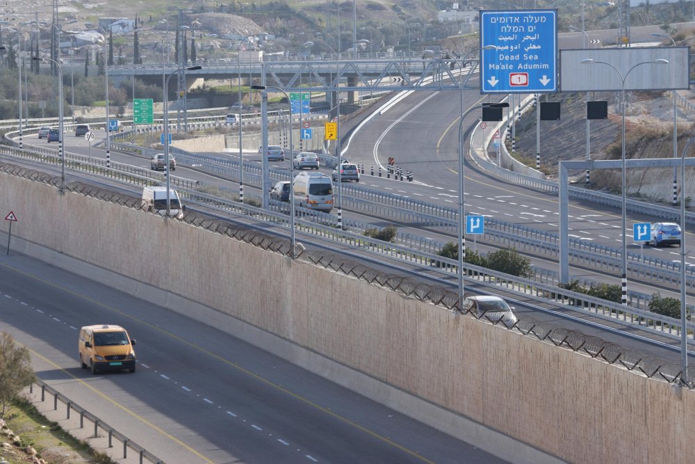
Referred to by Israelis as the “Jerusalem Envelope,” the wall around Jerusalem measures approximately 142 km, and only 4 km of it run along the Green Line.13 The enveloping wall encapsulates Jerusalem, with two consecutive layers that encircle the city and the wider region that surrounds it and to which it has historically always been connected.
Beginning from the northwest, where it embraces the Har Adar Israeli settlement, running north into south Ramallah, the wall then winds eastward to cut the region off from Jerusalem. It then continues south, cutting through Jerusalem’s eastern suburbs, before finally turning west to encompass the Har Homa and Gilo (Israeli) settlement blocs to the north of (Palestinian) Bethlehem, effectively cutting it off from Jerusalem.
The second layer of the planned and mostly unbuilt track of the wall encloses the region to the east of Jerusalem, which includes the E1 corridor, Ma‘ale Adumim, and Kfar Adumim. The track of the wall around these settlement blocs stretches to the northeast, halfway to Jericho, and southwest where it encloses the huge Gush Etzion settlement bloc to the west and southwest of Bethlehem, encompassing what is referred to by Israelis as “Greater Jerusalem” (see Israel’s Vision of a Greater [Jewish] Jerusalem).
The wall at the Qalandiya checkpoint, the main access point for entry to Jerusalem, July 14, 2021
Credit:
Mays Shkerat for Jerusalem Story
The wall at Hizma checkpoint, where Israeli yellow-plated cars are allowed to enter Jerusalem, July 14, 2021
Credit:
Mays Shkerat for Jerusalem Story
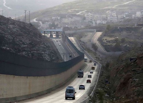
Construction to double the width of the Bethlehem Bypass Road (Highway 60 / the Tunnels Road) in Beit Jala, south of Jerusalem
Credit:
Sari Hammouri for Jerusalem Story
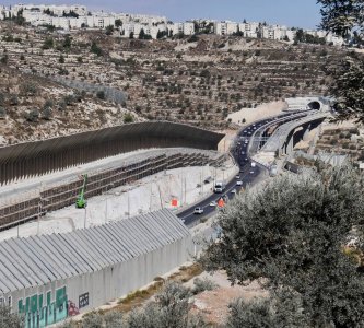
Recalling that Jerusalem was historically divided from 1948 to 1967 between a Jewish West side (ethnically cleansed in 1948, see The West Side Story) and a Palestinian Arab East side (divided by the Green Line), it should be clear that it is not by chance that 97 percent of the route of the “Jerusalem Envelope” was constructed on the eastern side of the city and far beyond its official boundary, swooping deep into occupied Palestinian land beyond the Green Line.14 The urban (all Palestinian) areas of East Jerusalem affected by the wall are mostly surrounded by high concrete walls and stone walls, in addition to the concertina wires and electronic fences bordered by large land ditches. Covering the rest of the route are the major Israeli-only bypass roads to the city that are prohibited to Palestinians, such as highway 443 in the north of Jerusalem,15 which isolates villages between Ramallah and Jerusalem, and highway 60, or the “tunnels road,” in the south of Jerusalem, which isolates villages to the east of Bethlehem and strangulates Beit Jala from the west.16
The wall also holds a network of radar devices, cameras, and watchtowers, with agricultural gates and military-run checkpoints, which only grant access to holders of Israeli identification cards (including Palestinian Jerusalemites with permanent-resident status) or for those with Palestinian Authority IDs who could obtain an entry permit.
A Palestinian vehicle drives on a newly opened road with an 8-meter-high wall segregating Palestinian traffic from a major Israeli highway in al-Za‘im village on January 23, 2019.
Credit:
Ahmad al-Bazz, Activestills
Geographic reengineering
The deliberate engineering of Jerusalem’s metropolitan area reflects how Israel uses the wall to alter the city’s demographic makeup, including keeping Palestinian communities apart. Indeed, the wall separates Jerusalem from its neighboring cities to the north and south, Ramallah and Bethlehem, and disrupts the urban continuity that holds East Jerusalem’s (Palestinian) villages and neighborhoods together. The wall also restricts the residents of those villages from accessing the city.
The wall winds within and without the jurisdiction of the Jerusalem municipality, cutting through Palestinian communities and separating them. In its wake, it creates multiple types of entrapped zones where Palestinians reside. Table 1 summarizes these various zones.
Table 1: Ways in which the wall has blocked Palestinian communities in the Jerusalem area from engaging with their own city
| Communities inside the municipal boundaries of Jerusalem but outside the wall (“exclaves”) | Communities outside the municipal boundaries but inside the wall (“enclaves”) | Communities cut off from the city, left outside both the wall and the municipal boundaries (“excisions”) | Communities cut off from the city, left both outside the municipal boundaries and the wall but are still completely encircled by the wall (“engulfments”) | Communities cut off from the city, left both outside the municipal boundaries and the wall but are surrounded by the wall and the mountainous terrain | Communities inside the wall and the municipal boundaries |
|---|---|---|---|---|---|
|
‘Anata (Dahiyat al-Salam and Ras Shihada) [parts of] |
Beit Iksa (planned wall route will engulf the town in the future) |
Abu Dis |
‘Anata [most of] |
Bidu |
Bab al-Sahira |
|
Battir [very small parts of] |
Dahiyat al-Barid [section of] |
‘Arab al-Jahalin |
Beit Hanina al-Balad |
Beit ‘Anan |
Beit Hanina |
|
Beit Jala (Beir Onah) [small parts of] |
al-Khalayla |
Bethlehem and its suburbs |
Bir Nabala |
Beit Duqu |
Beit Safafa |
|
Bethlehem [very small parts of] |
al-Nabi Samwil |
East Jerusalem [multiple Bedouin communities in] |
al-Jib |
Beit Ijza |
Dahiyat al-Barid [very small part of] |
|
al-Bira (Samiramees neighborhood) [parts of] |
al-Tur [small parts of] |
Hizma |
al-Judayra |
Beit Surik |
al-‘Isawiyya |
|
Eastern Jerusalem suburbs (al-Sawahira al-Sharqiyya, Sheikh Sa‘d, Abu Dis, al-‘Izariyya, and Hizma) [very small parts of] |
Wadi Hummus neighborhood in Sur Bahir [most of] |
al-‘Izariyya |
Khirbat Umm al-Lahim* |
Jabal Mukabbir |
|
|
Kufr ‘Aqab [most of] |
Jaba‘ |
Qatanna |
Khallat al-Nu‘man** |
||
|
Qalandiya refugee camp [about half of], in addition to al-Matar neighborhood |
al-Khan al-Ahmar |
al-Qubayba |
Khirbat Khamis** |
||
|
Qalandiya village [small part of] |
Kufr ‘Aqab [part of] |
Ramallah governorate (including Khirbat al-Misbah, Beit Liqya, Beit Sira, Marj Amira) [villages belonging to] |
Musrara |
||
| Shu‘fat refugee camp (including Ras Khamis) |
Mukhmas |
Old City of Jerusalem
|
|||
| al-Walaja [almost half of] |
Qalandiya refugee camp [part of] |
Ras al-Amud (including al-Shayyah) |
|||
|
Qalandiya village [most of] |
al-Sawahira al-Gharbiyya (al-Sala‘a and Abu Mughira neighborhood) |
||||
|
Rafat |
Sharafat |
||||
| al-Ram (including most of Dahiyat al-Barid) |
Sheikh Jarrah |
||||
|
Ramallah and its suburbs |
Shu‘fat |
||||
| al-Sawahira al-Sharqiyya (including Jub al-Rum and Khirbat al-Jurdhan) |
Silwan |
||||
| Sheikh Sa‘d |
Sur Bahir |
||||
| al-Walaja [almost half of] (planned wall route will engulf the town in the future) |
al-Suwwana |
||||
| al-Zai‘m |
al-Thuri (or Abu Tur) |
||||
|
al-Tur (or Mount of Olives) |
|||||
|
Umm Laysun |
|||||
| Umm Tuba | |||||
| Wadi al-Joz | |||||
| Wadi Hummus [part of] |
* Sometimes referred to as Kharayeb Umm al-Lahim
** Unlike the rest of the communities in this column, where most residents hold Israeli IDs, the residents of these two communities do not hold Israeli IDs but rather Palestinian Authority IDs (at the discretion of the state). Thus, they are trapped in a particularly untenable situation, as Israel considered them to be "illegal" in their own homes. Without an entry permit, they are not allowed to cross the municipal boundary and enter the city, although there is no physical obstacle preventing them from doing so. The wall is an obstacle in the opposite direction, imposing heavy restriction on their access of the West Bank where their ID would normally allow them to go.
Map 2 shows how the Separation Wall has fragmented and asphyxiated Palestinian localities (shown in green) into all degree of isolated and unlivable areas. Zoom in to view place names. Click to open the Legend and turn layers on and off.
A full understanding of the implications for residents requires layering this data against the various tiers of status conferred on Palestinians and the rules of movement and access that they entail (see Jerusalem: A Closed City and Precarious Status).
On the other hand, the wall connects Israeli settlements by “enveloping” them around the city to form the eastern, southern, and northern limits of what is termed “Greater Jerusalem.” These settlement blocs include Ma‘ale Adumim and Etzion, as well as the easternmost settlements of Kfar Adumim and Alon, and as far south as the settlements of Efrat and Kfar Etzion.17 That is, the track of the wall around the Ma‘ale Adumim settlement bloc cuts 14 km into the West Bank, which is 45 percent of the width of the territory. While the settlement blocs are yet to be officially annexed by the Jerusalem municipality, they are ipso facto part of the “Jerusalem Envelope,” since they are connected to the center of the city by a network of Israeli-only roads, bypassing the walls that fragment Palestinian residential areas—bringing the outside in, for one group only.18
Ultimately, the “Jerusalem Envelope” stretches from the Beit Horon settlement in the northwest to the settlement of Kfar Etzion in the southwest, within the Bethlehem district. Along its route, the wall envelops the expansive Ma‘ale Adumim settlement bloc that lies to the east of the city, folding it into “Jerusalem.” The 62 km sq of territory included in this envelopment amounts to 1 percent of the West Bank.
By also encapsulating the Gush Etzion settlement in the southwest, and the Giv’at Ze’ev settlement block in the northwest, Israel has effectively taken possession of an additional 102 km sq of Palestinian land. Together with the settlements within Jerusalem’s municipal boundaries, should the settlement blocs east of Jerusalem be formally annexed, it will result in the loss of 554 km sq of the West Bank, which equates to almost 9 percent of the total area of the West Bank.19
Although Israel constantly invokes security as the basis for the Separation Wall, the plans for the route of the “Jerusalem Envelope” were clearly determined according to a geodemographic and political logic bent on the Judaization of Jerusalem.20
Israel’s discourse of security is, indeed, dubious when it comes to the wall. Haim Ramon, a former member of the Israeli Knesset, told Israeli radio that “the fence was born, first and foremost, to prevent [Palestinians] from continuing to murder us.” But, he added, the barrier “also makes [Jerusalem] more Jewish. The safer and more Jewish Jerusalem will be, it can serve as a true capital of the state of Israel.”21 And Arnon Soffer, the first architect of the Separation Wall, said: “If you ask me how I did the map [of the wall] I would say 90 percent I took in my consideration demography, 2 or 3 percent holy sites, and maybe 7 or 8 percent only security.”22
Planning the Route of the Wall in Jerusalem
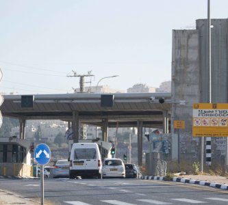
The route of the “Jerusalem Envelope” was established in the initial plan to build the Separation Wall, which envisioned the installation of a contentious obstacle around Jerusalem.23 The plan was preceded by the erection of seemingly random blockades and different obstacles, including ramparts, which were put in place by Israeli security forces during the 1990s and early 2000s.24 These were placed at the edge of the Jerusalem municipal boundaries, such as between Ras al-Amud and Abu Dis, along the roads leading to the city, and within the city, such as at Qalandiya and al-Ram25 (see Jerusalem: A Closed City).
In the early stages, Sharon and his Likud government were against the construction of a wall around the city of Jerusalem, because it went against their aspirations for a unified Jewish city.26 The wall was thus initially supposed to encircle the settlement bloc of Ma‘ale Adumim east of the city, which lies in the center of the West Bank. Under international pressure,27 Israel postponed this plan, and after careful calculation, the eastern route of the wall was to run adjacent to the municipal boundaries (themselves enlarged drastically and unilaterally in 1967—see Where Is Jerusalem? The Uncertain and Unfixed Boundaries of the City) with multiple breaches of that line.
Later, Sharon and his government changed course and went forward with constructing the wall around the city.28 A plan to build an additional layer of the wall around the major settlements surrounding Jerusalem did, however, go forward, with parts of it finished and others still awaiting approval.
The first stage of the Separation Wall was planned and approved by the government in June 2002. It began with a 24 km wall with two segments completed in the middle of 2003.29 One was located north, from the village of Beituniya to Qalandiya, separating Ramallah from Jerusalem and excising Kufr ‘Aqab from the city. The second was south, from Beit Sahur to Beit Jala, severing Bethlehem from Jerusalem.30
The segments that connect northern Jerusalem to the south were planned and approved by Israel’s Security Cabinet in September 2003:
The northwestern segment of the wall, west of Bir Nabala, was controversial among Israeli politicians. It was supposed to only involve the Ramot Alon neighborhood annexed by the municipality, but it ended up extending further to enclose Palestinian lands all the way north to Beituniya, isolating multiple Palestinian villages both from the West Bank and Jerusalem, such as Beit Iksa.33
To the south, the route that begins with the tunnel road cuts through the west of the nearby Palestinian town Beit Jala (adjacent to Bethlehem) and connects with a planned and partially built wall that envelops and connects the Gush Etzion settlements to Jerusalem, effectively surrounding Bethlehem from its western and southwestern sides. To the west of the tunnel road, another section of the wall encompasses the Har Gilo settlement southwest of Jerusalem, outside municipal boundaries, cutting off the Palestinian village of al-Walaja from Jerusalem to the north.
The rest of the segments of the wall to the east are built in stages, as settlement blocs and the complex networks of roads that connect them are constructed. Planned but only partially constructed in 2005, most of this segment, along with the E1 corridor—the area between al-‘Izariyya and ‘Anata, where the village of al-Za‘im lies, and that links Ma‘ale Adumim with the center of Jerusalem—requires further legal approval to be completed, since it is located in the center of the West Bank, threatening to completely separate its northern and southern halves.34 However, Israeli politicians are trying to find ways to bypass the legal complexities with the aim of cementing the E1 corridor, the borders of “Greater Jerusalem,” and the bifurcation of the West Bank.35
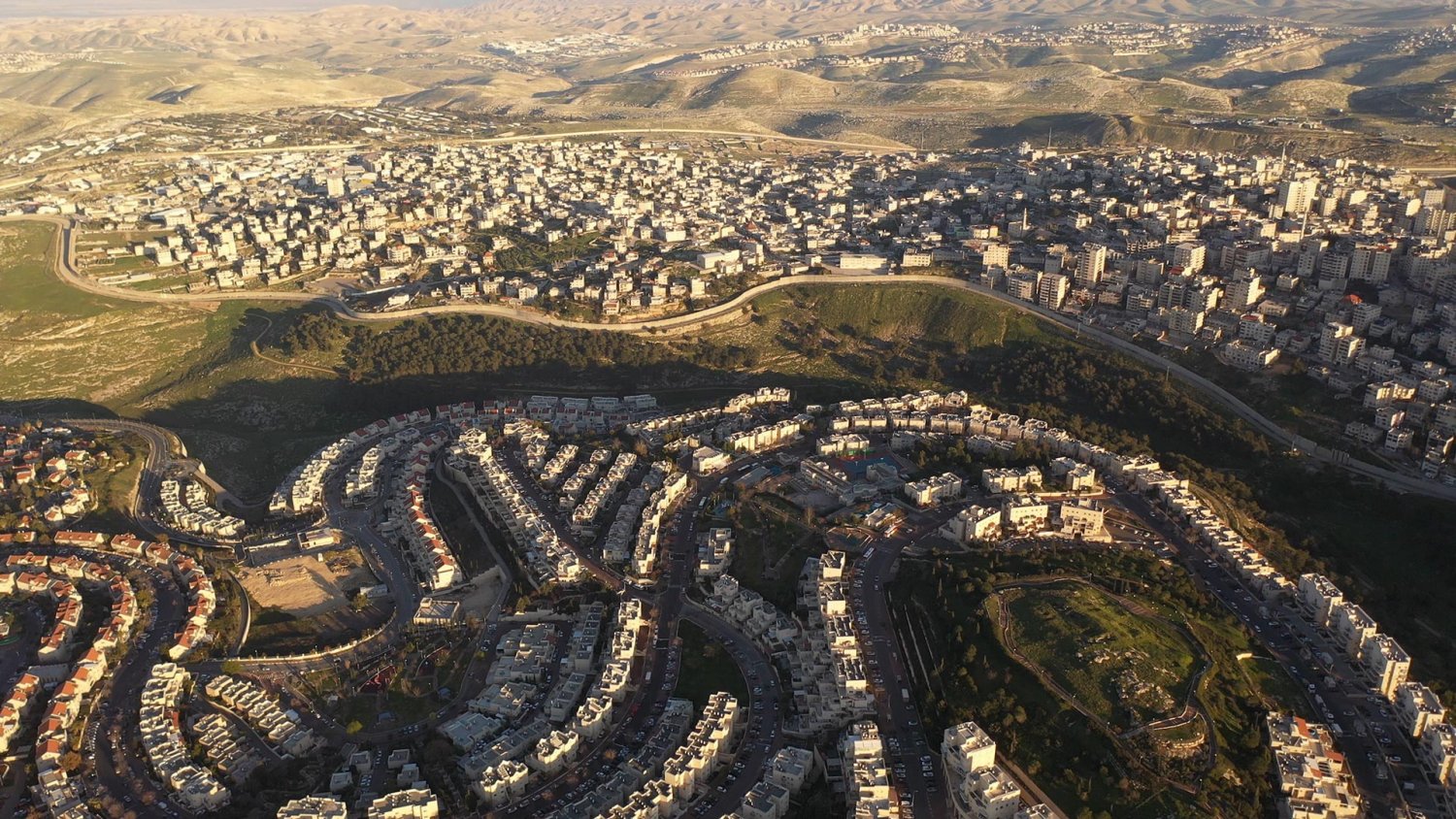
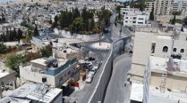
Aerial drone view of the Separation Wall excising the Palestinian town of ‘Anata and enveloping the Israeli settlement of Pisgat Ze’ev (undated)
Credit:
Shutterstock
Beyond Security: Objectives and Effects of Israel’s Wall
Engineering demographic dominance and permanent control
Connected to this is the direct policy of maintaining the minority status of Palestinian Jerusalemites, which Israeli policy aims to keep at less than 30 percent of the population.36 In this way, the wall functions within a larger trend of exclusionary government policies in East Jerusalem: to simultaneously shape and sustain a Jewish demographic majority while disrupting and degrading the city’s Palestinian presence and any future potential for a Palestinian claim to the city by virtue of presence.37 Indeed, the wall has separated more than 150,000 Palestinian Jerusalemites from the rest of Jerusalem, even though they hold Israeli IDs. This includes Palestinians in Kufr ‘Aqab, Dahiyat al-Barid, Shu‘fat refugee camp, al-Sawahira, and al-Walaja.
Francesco Chiodelli, an expert on planning and spatial regulation in the Jerusalem context, elucidates what he refers to as “four main territorial outcomes of the wall”:
The most direct way in which the wall manages the demographic of Jerusalem balance is through its gerrymandering route, which, through multiple divergences, works to include and exclude spaces based on demographic consideration. This includes leaving any territory under municipal jurisdiction that is heavily populated by Palestinians (such as Kufr ‘Aqab and Shu‘fat), and curbing its growth.
On the other hand, inclusion is carried out by ensuring the wall extends far beyond current municipal lines in order to encompass outlying Jewish settlements in the occupied West Bank such as Har Gilo, northwest of Bethlehem, and territory for future expansion. As Merav Amir, an Israeli cultural and political geographer, put it, these deviations in the route of the wall “were instigated by an effort, whenever possible, to exclude heavily populated Palestinian areas and to extend the possibility of Jewish expansion, all the while without creating a blunt digression from city boundaries.”39
The wall also consolidates aquifers and farmland, as well as holy places in the West Bank, for Israeli settlers. By contrast, it suffocates Palestinian villages, preventing their expansion, and blocking their residents from access to basic needs, services, and common infrastructure. In the long run, this deliberate strategy is meant to pressure Palestinian residents to move out in a process of slow “self-eviction” as the conditions needed to sustain even the barest sort of life evaporate.
The wall has also facilitated annexation, house demolitions, land confiscation, and the expansion of surveillance and control of the Palestinian population in and around Jerusalem through the proliferation of high-tech CCTV cameras and sensory radars installed within it.
Destroying the idea of an Arab metropolitan center in East Jerusalem
The wall’s impact on urban East Jerusalem is also evident in its disruption of Palestinian Jerusalem as a physical space in order to construct a Jewish one. The wall thus works together with the settlement enterprise in order to “destroy the idea of an Arab metropolitan center in East Jerusalem,” while at the same time establishing “the basis for the creation of a ‘Greater Jewish Jerusalem.’”40
In other words, while it creates what Rassem Khamaisi calls an “Amputated Jerusalem Metropolitan,”41 the wall simultaneously “mothers a ‘Greater Jewish Jerusalem.’”42 The idea of amputation is echoed by Chiodelli, who describes the impact of the wall on Arab East Jerusalem in a historical context:
Despite the increasingly tough obstacles set up between Jerusalem and the West Bank by Israeli authorities, for decades East Jerusalem and the suburbs worked as a strictly integrated and interrelated urban system (Allegra, 2010; Shlay & Rosen, 2010). The wall’s construction breaks off these relations, in a sort of spatial amputation of the Arab city (UN OCHA oPt, 2011b): East Jerusalem is wrenched from its historical relational space and trapped within an alien Jewish space. Atrophy seems to be its probable destiny.
In addition to the annexation of territory and space, the wall facilitates Israeli control and surveillance over Palestinian territory it does not officially control, and in which it does not maintain demographic dominance.43
Connecting Israeli settlements
As it restricts Palestinians’ mobility and access, the wall connects settlements in Palestinian land. Indeed, the same bypass roads that function as part of the wall to suffocate and fragment Palestinian residential areas contribute to connecting Jewish settlements within the municipal boundaries and settlement blocs in the West Bank. These include Gush Etzion in the south, Ma‘ale Adumim in the east, and Giv’at Ze’ev in the north.
This contiguity between settlements in and around Jerusalem extends well beyond the city, all the way to the coastal plain. For example:
Fragmenting Palestinian space and life
The wall’s impact on Palestinian life is felt continuously. The wall created multiple realities for Palestinians, who are fragmented into different localities with varying infrastructures and services, connections to surroundings, regulations of movement and access, and so on.
In East Jerusalem and its environs, the geographical fragmentation that the wall creates effectively obstructs and reshapes the social, cultural, and economic fabric that had historically connected the Palestinian communities within and around Jerusalem. After two decades with the wall as a fact of everyday life, a whole Palestinian generation’s relationship to Jerusalem has been transformed.
Urban life, mobility between neighborhoods, towns, and villages, and access to basic services, housing, agriculture, and cattle grazing are all obstructed by al-Jidar. Indeed, the UN Office for the Coordination of Human Affairs (OCHA) found that the wall physically separates tens of thousands of Palestinians in Jerusalem from the city: “They must cross crowded checkpoints to access health, education and other services to which they are entitled as residents of Jerusalem.”44
The wall also destroys different sectors of the Palestinian economy, both in Jerusalem and throughout the rest of the West Bank. While an exhaustive analysis is beyond the scope of this Backgrounder, some key impacts include:
With limited access to economic outlets on either side of the wall, many of Jerusalem’s Palestinians have become impoverished. Indeed, the poverty rate among Palestinians in Jerusalem rose from 60 percent before the construction of the “Jerusalem Envelope” to 80 percent afterward.46
The fragmentation of Palestinian community and lives wrought by the wall has been multidimensional. Below we lay out five different types of fragmentation.
1. Severance of the Ramallah-Jerusalem-Bethlehem metropolitan continuum: The Ramallah-Jerusalem-Bethlehem metropolitan continuum, which is at the heart of the Palestinian geography, is severed by the wall. Forming a metropolitan region that is home to more than one million people, the three historically interconnected centers of Ramallah, Jerusalem, and Bethlehem were sliced by the wall into three large and discontinuous subregions. According to official Palestinian statistics, Ramallah and its subregions are home to nearly 350,000 residents, Jerusalem to 460,000, and Bethlehem to another 230,000.47 With the widespread obstacles that are part of the Jidar complex and the Separation regime, including checkpoints, roadblocks, the permit system, and military outposts, residents of the three city centers are not able to travel, thereby limiting Palestinians’ cultural and economic growth and creating a more localized, alienated sense of identity.
While Bethlehem and Jerusalem have been historically connected for at least the last 2,000 years, a massive and continuous concrete wall blocks residents in the Bethlehem region (including Beit Sahur and Beit Jala) from entering Jerusalem except through a few allowed checkpoints, which require applying for cumbersome entry permits that are commonly denied. Similarly, residents of Ramallah and its surrounding towns, including al-Bira, Kufr ‘Aqab, Bir Zeit, and beyond, are only able to enter Jerusalem in similarly restrictive, completely controlled, and often-not-permitted ways. To Palestinians all around Jerusalem, it feels as if Jerusalem—formerly the heart of the region—has become unreachable.
At the same time, Jewish settlers in East Jerusalem have continuous access to Israeli-only tunnel roads that undercut Beit Jala if they want to travel to the settlements east of Bethlehem or as far south as Hebron. These roads also function as walls.
To the west of Bethlehem, and to the northwest of Jerusalem, two main Israeli-only bypass roads cut through the middle of the West Bank. Highway 60, which cuts through the Beit Jala and Khadr areas, as well as highway 443, which is south of Rafat, separate residents of these areas from Jerusalem and the rest of the West Bank, and they effectively ghettoize them. Additionally, both roads will be walled on both sides.48
The Ramallah-Jerusalem-Bethlehem continuum has been part and parcel of Palestinian history and culture for centuries. The wall has obliterated that continuum, ensuring the slow erosion of Palestinian economic, cultural, political, and social relations.
The Separation Wall blocked the road between the historically interconnected cities of Bethlehem and Ramallah, forcing Palestinians to use a long, roundabout, hazardous route.
2. The bifurcation of the West Bank: In its encirclement of Jerusalem, the “Jerusalem Envelope” created by the wall severs the connection between Palestinians across the West Bank more broadly. Located in the center of the West Bank—indeed, in the center of historic Palestine—the “Jerusalem Envelope” effectively blocks the northern part of the West Bank (including the cities of Ramallah, Nablus, and Jenin, as well as their surrounding towns and villages) from its southern region (including the cities of Bethlehem and al-Khalil, and the many towns surrounding them, such as Beit Jala, Beit Sahur, and Yatta).
If construction on the E1 corridor continues as planned, effectively cementing the connection between the Ma‘ale Adumim settlement bloc and East Jerusalem, the Israeli government will have officially bifurcated the West Bank in half and at its narrowest point, disconnecting north from south, and making any future Palestinian state nonviable.49
3. The destruction of Jerusalem’s suburbs and their relationship with Jerusalem: Palestinian communities that orbit Jerusalem in its eastern suburbs are connected to the city center by a common infrastructure and are dependent on it for work, trade, and education. However, the wall forbids “the formation of a normal relationship between the city [of Jerusalem] and its surrounding neighborhoods and suburbs,” a historically interdependent relationship.50 The wall excludes a number of these communities, such as al-Za‘im, ‘Anata, Kufr ‘Aqab, and al-Ram, from the center of Jerusalem, restricting their residents from accessing it.
Most evident is how the wall’s meandering route dissects Jerusalem’s northeastern suburbs, blocking villages and neighborhoods from Jerusalem, a city center around which these suburbs have historically been organized. These include Beit Iksa, al-Jib, Bir Nabala, al-Ram, Hizma, ‘Anata, al-‘Izariyya, al-Za‘im, Abu Dis, al-Sawahira al-Sharqiyya, and Sheikh Sa‘d.
Jerusalem’s eastern Palestinian towns, including al-‘Izariyya and Abu Dis, have been completely separated from one another and from Jerusalem by the Separation Wall.
In al-‘Izariyya, the wall literally blocks off the main road to Jerusalem, severing the town's access to the city that is 3 kilometers away, as seen in this aerial shot, taken on August 30, 2021.
Credit:
Muath al-Khatib for Jerusalem Story
The wall abuts a main road in al-‘Izariyya, right cross from private homes, as seen here on August 30, 2021.
Credit:
Muath al-Khatib for Jerusalem Story
The wall also separated these neighborhoods from each other, effectively disrupting once continuous urban space. For example, the territory between al-‘Izariyya and the Old City of Jerusalem has been built-up and inhabited for generations. Yet the wall has severed this continuity.
The result has been the destruction of shared economic, cultural, and social realities, including education and healthcare, between villagers and their historic city center. This is especially damaging to communities blocked by the settlement blocs, in addition to the wall. Residents of al-‘Izariyya and Abu Dis, for example, have few alternatives to healthcare and education than those offered in Jerusalem, yet they are largely inaccessible due to the wall.
Al-Ram, for instance, a northern suburb of Jerusalem that lies outside the city’s municipal boundaries, is excluded from Jerusalem, and is surrounded by the wall from all sides. Most of al-Ram’s 60,000 Palestinian residents depend on Jerusalem for work, education, and healthcare.51 This means that daily life for residents of al-Ram entails traveling to the notorious Qalandiya checkpoint, waiting in long queues for hours, and routinely being denied entry for arbitrary reasons at military checkpoints (see Jerusalem: A Closed City and Banned from Entry).52 At times, it also means climbing over the wall, or going through gaps in it, thus risking their lives.
A generation’s labor is lost when the wall comes between a man and his business. A Photo Story.
4. Internal fragmentation into ghettoized exclaves and enclaves: The noncongruence between the route of the wall and the municipal boundaries of Jerusalem has trapped multiple Palestinian communities on the outskirts of the city within liminal spaces, referred to as exclaves and enclaves. Exclaves (areas excised from the city by the wall) lie inside the municipal boundaries but outside the wall, and enclaves (outside areas entrapped into the city by the wall) lie outside the municipal boundaries but inside the wall (see Table 1 and Map 2 above). Communities that fall into this category make up at least 150,000 residents, likely more, most of whom reside in Kufr ‘Aqab and Shu‘fat refugee camp.53
The Separation Wall and municipal neglect have transformed the Palestinian village of Kufr ‘Aqab into an overcrowded, dangerous urban ghetto slum.
The “Apartheid Road,” where the wall separates Israeli and Palestinian traffic
Credit:
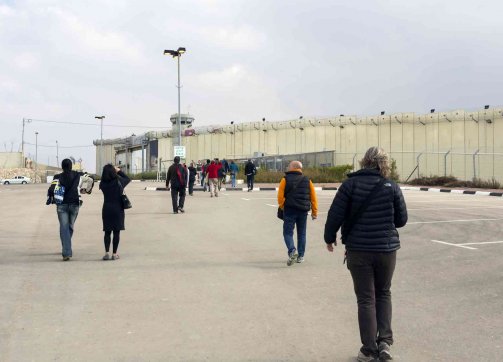
Approach to Checkpoint 300, which controls the passage between Jerusalem and Bethlehem for Palestinians, January 2, 2013
Credit:
Shutterstock
Daily, residents must cross a single and very crowded checkpoint that connects them to Jerusalem, the center of their educational, professional, social, and cultural lives. This means that inspection by the occupation authorities (sometimes turning violent), congested traffic, long queues, and delays, as well as random closures denying all access to the city, are part of everyday life for these residents, although most have residency status and hold Israeli IDs.
The more than 7,000 Palestinian residents of the enclaves are severed from the rest of the West Bank by the wall, left on its inner "Jerusalem" side, but at the same time, they are excluded from Jerusalem by virtue of being outside the municipal boundaries. Moreover, their status as Palestinian Authority ID-holders does not allow them to cross that boundary and enter the city without a permit, even though there is no physical obstacle preventing them from doing so.54
Wadi Hummus, for instance, is a neighborhood that belongs to the Sur Bahir village in southeastern Jerusalem. In 1967, most of Sur Bahir was compulsorily incorporated into the newly expanded municipal boundaries. Around 1,500 to 2,000 dunums were left outside, including the neighborhood of Wadi Hummus. When the wall was built, at the residents’ request (they petitioned the Supreme Court), it was built east of the municipal boundary in this area so that it enfolds Wadi Hummus inside its embrace as well as Sur Bahir (since they were basically one and the same for their residents).
Today, although many people living in Wadi Hummus hold Palestinian Authority IDs, the PA has no way of reaching Wadi Hummus, because it lies on the Jerusalem side of the wall, where it is forbidden to operate. While the PA leases building permits to residents there, these are considered null by Israeli authorities. And since Israel does not consider Wadi Hummus a legitimate part of Jerusalem, it provides it with little to no services at all. In this way, Wadi Hummus is enclaved.
The legal ambiguity of the neighborhood and its closeness to the wall raised multiple controversies for the Israeli government, culminating in the Israeli Supreme Court’s summer 2019 decision to demolish 12 multifamily homes that were under construction in Wadi Hummus. These structures, which were completely dismantled for “security reasons,” left multiple Palestinian families homeless.55
5. Alienation of farmlands: The route of the wall isolates the most fertile farmlands and grazing lands from the Palestinian villages to which they belong, restricting or forbidding Palestinians’ access to those lands. As an example, the farming village of al-Walaja to the southwest of Jerusalem is divided by the wall, forbidding its residents access to their farmlands on the other side of the barrier. Similarly, most of the grazing lands of Hizma and Jaba‘ are on the side of the wall to which residents of the villages have no access, effectively obliterating their centuries-old tradition of grazing livestock there.
In preventing Palestinians in roughly 150 communities from their right to freely access and cultivate their lands, the wall damages the Palestinian agricultural sector, a core component of the Palestinian economy. According to the UN Relief and Works Agency (UNRWA), residents of Biddu, Beit Ijza, and Beit Surik lost access to 31–38 percent of the total area of their communities, in addition to 20 percent of their agricultural lands in the West Bank, which lay on the other side of the wall. While exact figures vary depending on the source, village by village, it is estimated that Biddu lost over 23 percent of its agricultural land; Beit Surik, over 11 percent; and Beit Ijza, over 30 percent.56
Throughout the West Bank, and in areas where the wall has been completed, Israel built 84 military-controlled gates through which farmers are granted very limited access.57 These gates are mostly meant to make Israel appear to the international community to be “enabling life to go on undisturbed as before.” That is, in 2016, “only nine of these gates were opened daily; ten were opened only a few days a week and during the olive harvest season; and 65 gates were only opened for the olive harvest.”58
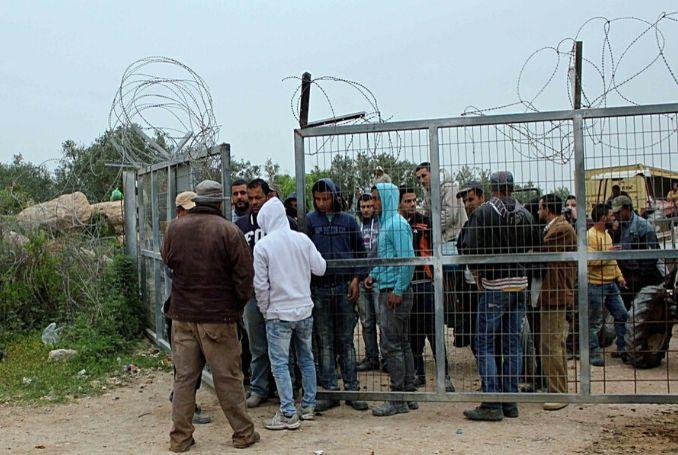
Farmers waiting for the agricultural gate to be opened
Source:
Social media, via Palestine Chronicle
The “Jerusalem Envelope” has about 15 agricultural gates, and all but 3 of them operate only seasonally (such as during the olive harvest).59 Six gates are found in the northwestern section of the wall60 to access agricultural lands belonging to the villages in the Biddu enclave, including Qatanna, al-Qubayba, Biddu, Beit Surik, and Beit Ijza.61 One gate serves al-Tira, a village completely surrounded by the wall and intersected by two bypass roads. Another gate serves Beituniya, whereas four gates serve Beit Hanina al-Balad,62 which is also completely encompassed by the wall. To the northeast, two gates serve the farmers in Jaba‘ and Hizma. To the south, two gates serve farmers in Beit Sahur, and one serves farmers in Beit Jala.63
Very few of these gates are staffed throughout the year, while most operate only seasonally, and even then, not on a daily basis. When they do operate, gates open only twice a day for 10 to 15 minutes to facilitate the entry and exit of the farmers.64 Decisions to open or close the gates are arbitrary and the timing of opening is never dependable.
Only Palestinian farmers who can prove direct ownership over particular pieces of land on the other side of the wall can use the gates to pass, and only after they obtain what is known as a “farming work permit.” Farmers apply for these permits from their local councils, who then submit the requests to Israel’s Civil Administration authorities in Area C. As with most permits issued by the Israeli government to Palestinians, many are denied; reasons for denial are rarely given. Indeed, over the years the rate of approval for permits applied for by farmers owning land behind the wall dropped sharply (from 76 percent approval in 2014 to 28 percent in 2018).65
The process of proving ownership is very challenging and excludes those farmers who lost lands they have historically tended without owning proper documentation proving private ownership. The Israeli Civil Administration only allows the landowner, who is often an elderly man, to enter through the gates, preventing family members from accompanying him. In addition to destroying the tradition of family farming, which has been passed down for generations in Palestine, one person alone—let alone an elderly person—cannot harvest enough olives in a day to earn the family the income they would need to subsist on their harvest. This effectively kills the economic value of the olive harvest, traditionally a mainstay of livelihoods, for Palestinian villages.
The gates also impose restrictions on the entry of agricultural vehicles and equipment, making farming even more difficult. Moreover, as these gates mostly operate seasonally, the possibility for year-long cultivation shrinks, resulting in the decline of the quality and production rate of crops. This leads farmers to abandon their crops and, ultimately, their lands.66
The difficulties entailed in tending to the lands beyond the wall leads farmers to abandon those lands and tend to the few they have left on their side of the wall. It leads many others to choose a different line of work, such as construction, which is usually found on the other side of the wall in Jerusalem, and which has its own difficulties and limitations. The noncultivation of the land may also subject it to confiscation by the Israeli government.67 In accordance with the “Bor Lands Law,” Israel is allowed to annex “Bor” lands, which are lands that have not been tended to for three to five years. This, to be sure, is Israel’s end goal in Jerusalem, the West Bank, and throughout historic Palestine. The Separation Wall aids very handily in the achievement of that goal.
Contributors
Researcher and Writer: Amir Marshi, Jerusalem Story
Editor: Nadim Bawalsa, Jerusalem Story
For more about the concept of a regime of separation, see Hilla Dayan, “Regimes of Separation: Israel/Palestine and the Shadow of Apartheid,” in Power of Inclusive Exclusion: Anatomy of Israeli Rule in the Occupied Palestinian Territories, ed. Adi Ophir, Michal Givoni, and Sari Hanafi (Princeton: Zone Books, 2019), 281–322.
Chris McGreal, “Wall Makes Jerusalem ‘More Jewish,’” Guardian, July 12, 2005.
International Court of Justice, “Legal Consequences of the Construction of a Wall in the Occupied Palestinian Territory,” December 8, 2003.
Kobi Michael and Amnon Ramon, A Fence around Jerusalem: The Construction of the Security Fence around Jerusalem (Jerusalem: The Jerusalem Institute for Israel Studies, 2004).
Frances Chiodelli, “Re-shaping Jerusalem: The Transformation of Jerusalem’s Metropolitan Area by the Israeli Barrier,” Cities 31 (2013): 417–24.
B’Tselem, “Under the Guise of Security.”
Different sources give different estimates of the length of the wall. B’Tselem puts it at 620 km (B’Tselem, “The Separation Barrier—Statistics,” January 1, 2017); Nora Biatra-Rayan and Daniela Yanai estimate 760 km (Nora Biatra-Rayan and Daniela Yana, “The Impact of the Separation Wall on Jerusalem,” Palestine-Israel Journal of Politics, Economics and Culture, 2007); and Stop the Wall puts it at 810 km (Stop the Wall, “The Wall”).
B’Tselem, “The Separation Barrier,” November 11, 2017.
If Americans Knew, “Israel’s Confiscation Barrier through the Palestinian West Bank.”
Ten percent according to B’Tselem, “The Separation Barrier,” and 20 percent according to Stop the Wall, “The Wall.”
B’Tselem, “The Separation Barrier.”
Chiodelli, “Re-shaping Jerusalem,” 419.
Chiodelli, “Re-shaping Jerusalem,” 419.
B’Tselem, “Route 443—West Bank Road for Israelis Only,” January 1, 2011.
Michael and Ramon, A Fence around Jerusalem, 53; and POICA, “The Strangulation of Beit Jala City,” April 16, 2008.
Jeffrey Heller, “U.S. Pressure Delays Israel’s ‘Greater Jerusalem’ Bill: Legislator,” October 29, 2017.
Zena Agha, “Israel’s Annexation Crusade in Jerusalem: The Role of Ma’ale Adumim and the E1 Corridor,” March 26, 2018.
B’Tselem, “The Separation Barrier.”
Chiodelli, “Re-shaping Jerusalem,” 419. See also B’Tselem, “Under the Guise of Security.”
McGreal, “Wall Makes Jerusalem ‘More Jewish.’”
Al Jazeera English Documentary, “Walls of Shame: West Bank Separation Wall,” July 23, 2016.
Michael and Ramon, A Fence around Jerusalem, 49.
B’Tselem, “The Separation Barrier: Position Paper,” September 2002.
Michael and Ramon, A Fence around Jerusalem, 50.
Netta Ahituv, “15 Years of Separation: The Palestinians Cut Off from Jerusalem by the Wall,” Haaretz, March 10, 2018.
Michael and Ramon, A Fence around Jerusalem, 52.
Ahituv, “15 Years of Separation.”
Rassem Khamaisi, Rami Nasrallah, and Michael Younan, “Jerusalem on the Map III,” International Peace and Cooperation Center 15 (2005): 73.
B’Tselem, “Under the Guise of Security.”
Khamaisi et al., “Jerusalem on the Map III,” 73–74.
B’Tselem, “Israel Plans to Imprison Five Palestinian Villages Near Jerusalem in an Enclave,” March 2, 2006.
Amos Harel, “Flying in Face of Previous Government’s Decision: Temporary Route of West Bank Fence Puts Beit Iksa on ‘Wrong Side,’” Haaretz, July 29, 2009.
The Electronic Intifada, “Construction Moves Forward on Barrier around Ma’aleh Adumim,” August 26, 2005.
Peace Now, “Road to Allow E1 Construction Is Being Promoted,” March 9, 2020.
Rassem Khamaisi, “Jerusalem Demography: History, Transitions, and Forecasts,” Jerusalem Quarterly 82 (2020): 118.
Menachem Klein, “Old and New Walls in Jerusalem,” Political Geography 24 (2005): 53–76.
Chiodelli, “Re-shaping Jerusalem,” 420.
Merav Amir, “On the Border of Indeterminacy: The Separation Wall in East Jerusalem,” Geopolitics 16, no. 4 (2011): 768–92.
Chiodelli, “Re-shaping Jerusalem,” 417.
Rassem Khamaisi, “The Amputated Jerusalem Metropolitan,” Palestinian Politics 4, no. 14 (1997): 32–49.
Chiodelli, “Re-shaping Jerusalem,” 418.
Chiodelli, “Re-shaping Jerusalem,” 432.
UNOCHA, “Occupied Palestinian Territory: Humanitarian Facts and Figures,” December 21, 2017.
Biatra-Rayan and Yanai, “The Impact of the Separation Wall.”
Ahituv, “15 Years of Separation.”
Stop the Wall, “The New Israeli "Disengagement Plan’ Map”; B’Tselem, “Separation Barrier by Beit Jala: Critically Harming Town to Lay Groundwork for Annexation,” November 12, 2015.
Zina Agha, “Israel’s Annexation Crusade.”
Rassem Khamaisi, “Toward Shaping a Vision for the Development of Jerusalem’s Suburbs: al-Za‘im, ‘Anata, al-Ram, and Kufr ‘Aqab as Examples” [in Arabic], Omran for Social Sciences 8, no. 30 (2019): 7.
B’Tselem, “The Separation Barrier Surrounding a-Ram,” January 1, 2016.
B’Tselem, “A Wall in Jerusalem—Obstacles to Human Rights,” 2006.
B’Tselem, “The Separation Barrier.”
Nadav Shragai, “The Unique Status of the Jerusalem Suburb of Wadi Hummus,” Jerusalem Center for Public Affairs, August 12, 2019.
Yara Hawari, “Wadi Hummus: Another Israeli Celebration of Ethnic Cleansing,” Al Jazeera, July 23, 2019.
UNRWA, “Biddu Enclave of the Jerusalem Governorate—UNRWA Mini Profile,” October 2014.
UNOCHA, “The Barrier Gate and Permit Regime Four Years On: Humanitarian Impact in the Northern West Bank,” November 2007.
B’Tselem, “The Separation Barrier.”
UNOCHA, “Record Yield Reported from 2019 Olive Harvest,” February 28, 2020.
B’Tselem, “Interactive Map.”
According to UN data, the population of this enclave is about 30,000. Many of the residents are refugees from the town of Lydda, from whence they were expelled in 1948. UNRWA, “Biddu Enclave.”
UNOCHA, “West Bank Access Restrictions,” United Nations Office for the Coordination of Humanitarian Affairs, June 2020.
B’Tselem, “Interactive Map.”
UNRWA, “Biddu Enclave.”
UNOCHA, “Fewer Permits Granted to Access Land behind Barrier,” March 18, 2019.
B’Tselem, “The Separation Barrier.”
Chiodelli, “Re-shaping Jerusalem,” 419.